Round Fort Bakkerskil
This route leads you along the Oostwaardpad from Fort Bakkerskil, past fields and the small river Bakkerskil. Visit the historic Papsluis lock and finish with something tasty on the fort's terrace. A varied route on the edge of the Biesbosch!
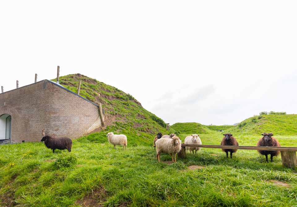
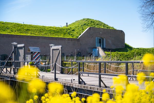
We start at Fort Bakkerskil (Kildijk 143 in Nieuwendijk), a unique bed & breakfast with a nice terrace and situated on the edge of National Park De Biesbosch. The fort is part of the Nieuwe Hollandse Waterlinie and a little further on is the Papsluis from 1815, an inlet that could flood the land when threatened.
We walk a short distance over the dike towards 13 and then descend (through a gate) towards 15. This walk is part of a route set out by farmers called 'Oostwaardpad'.
A beautiful initiative where proud farmers protect their field edges.
We start at Fort Bakkerskil (Kildijk 143 in Nieuwendijk), a unique bed & breakfast with a nice terrace and situated on the edge of National Park De Biesbosch. The fort is part of the Nieuwe Hollandse Waterlinie and a little further on is the Papsluis from 1815, an inlet that could flood the land when threatened.
We walk a short distance over the dike towards 13 and then descend (through a gate) towards 15. This walk is part of a route set out by farmers called 'Oostwaardpad'.
A beautiful initiative where proud farmers make their field edges available to hikers. Along the way we come across information signs. At 15 we turn left in the direction of 11. On the left we see the Papsluis. An imposing structure and we can imagine how important this lock was in the strategic plan of the Nieuwe Hollandse Waterlinie. We walk along the small river Bakkerskil, sometimes along a field, sometimes through a small forest.
After 11, we follow the signs to 85, where there is a tow ferry to the other side. Although we stay on this side of the water, we try the ferry to take a few photos. From 85 we walk to 84 (the route can also be extended to 83 here) and keep right towards 10. We enjoy the typical Dutch polder landscape with, depending on the month, views of sugar beets, onions and potatoes. We follow 17. Crossing the fields is quite tough here and there. Heading toward 15, the route is a nice variety of groves and vistas. The shade of the trees provides coolness in summer and makes us curious about the rest. Again we walk in a straight line along arable land, with a right angle turn to the left at the end. After 17 we walk back via 15 and 13 and are back at Fort Bakkerskil where we enjoy a well-deserved cup of coffee and goodies. Have fun!
The terrace of Fort Bakkerskil is open from April through September on Wednesdays and Thursdays from 10:30 am to 5:00 pm & on Fridays, Saturdays and Sundays from 10:30 am to 6:30 pm. Check socials for other months.
Dogs are not allowed on this route due to crossing farmland. Please note, in heavy rain, the unpaved trails are muddy. So put on good shoes/boots.
What you will see
- 13
- 15
- 11
- 85
- 84
- 10
- 17
- 15
- 13